Scroll Top

Digital Twin of your city

With DIGITWIN you get data-driven social insight into your region or city directly online on your screen. Our customers use this for, among other things:

Support in understanding and analysing the built environment, sustainability, mobility and safety

Efficient, online and data-driven work.

Link to your own static and live data sources in a smart city dashboard

Effective, dynamic and attractively designed communication within and outside the organisation

DIGITWIN is modular and can be used both with your own data and with our enriched data packages. You always remain the owner of your own datasets. In addition, we offer customization to turn your questions into solutions.
digitwin

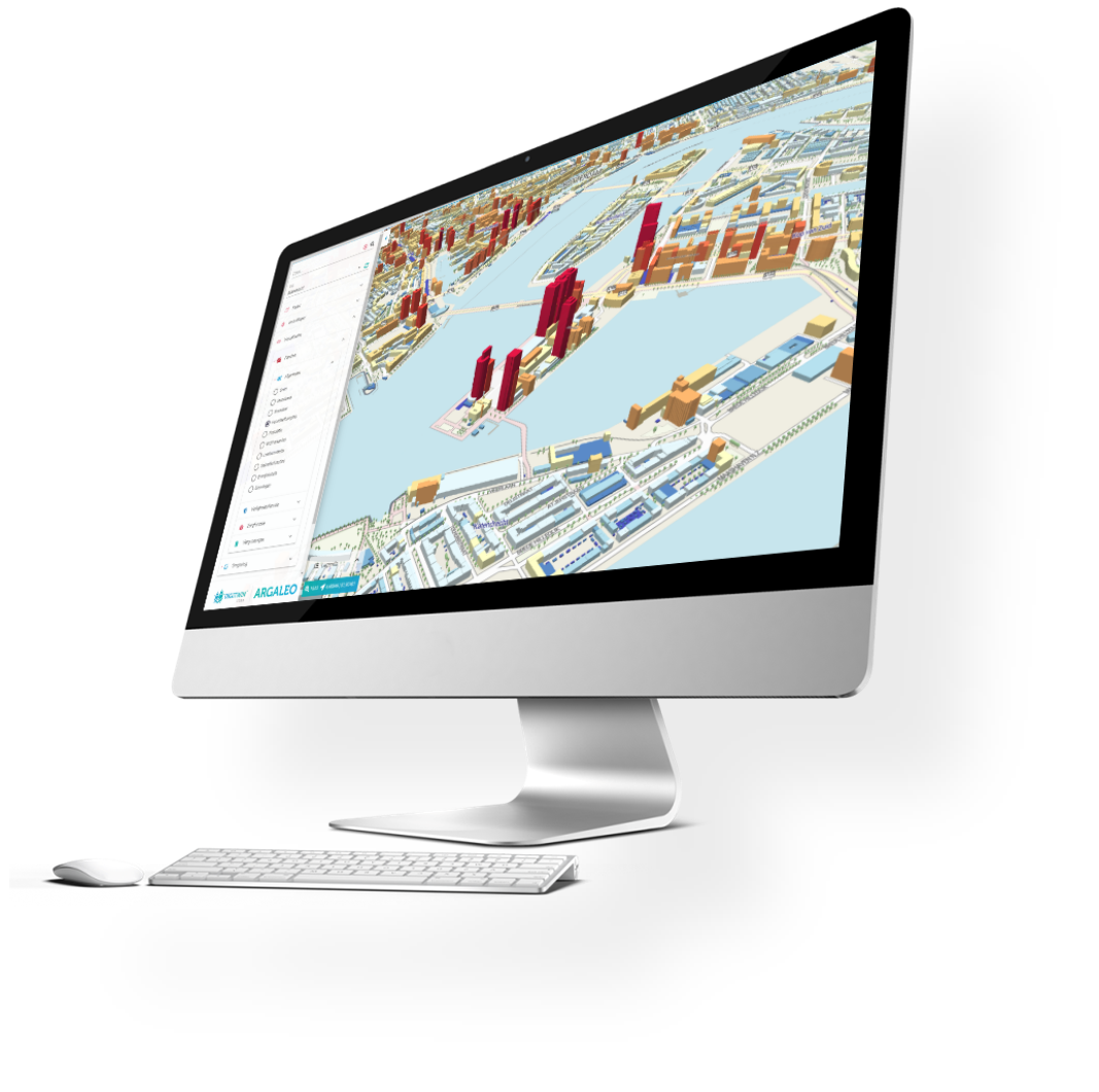
DIGITWIN is a leading 3D web application that converts your own datasets and those from the Environment Server into valuable insights. From the user-friendly menu, one press of a button gives access to current information and answers. This makes our Digital Twin a fast, accessible online tool that you can use on a small and large scale.

From overload to overview

DIGITWIN makes standard use of the data service Omgevingsserver, also known as data-as-a-service, is an always up-to-date digital data counter that we continuously enrich with new data. We make this data 'bite-sized' by cleverly combining and visualising all the data. In doing so, we only provide insight into what you need: no overload, but an overview. In this way we add value to data: we bring it to life in your own online environment.

Reliable resources & relevant enrichment

We retrieve source data, enrich that data and then show you exactly what you need. With our data collection and smart filtering, you'll save hundreds of hours of research per year - and with more concrete, compelling results. In addition to excellent visualisation, we also guarantee the best enrichment of the necessary data.

Relevant data better in view

From energy labels for dwellings to demographic data from Statistics Netherlands, we filter exactly what is needed to display data from more than 100 public and updated sources. We put map images (such as WMS, TMS and 3D vector tiles) and data sets (such as WFS, .OBJ and Excel) in a secure custom 3D environment - this means static data is always vividly visible.

> 200 Unique Datasets

BAG

Basic registration Addresses and Buildings

BGT

Basic registration Large-scale Topography

NHR

Trade register

AHN

Current Altitude file Netherlands

LRK

National Register Childcare

BRT

Basic registration Topography

BRK

Basic registration Land Registry

CBS

Demographic district and neighbourhood data

RRGS

Register of Riskositions Hazardous Substances, from Risk map

imro

Ruimtelijkeplannen.nl (including zoning plans)

woz

Valuation of Real Estate

ndw

National Road Traffic Database

RCE

Cultural Heritage Register

AR

Antenna register

RHD

RWS Hydrographic data

EL

Energy labels

NS

Live train positions

OS

OpenStreetMap road network

Interested?

Want to know more about DigiTwin and our data services?